
Name:
26-V26-US3111
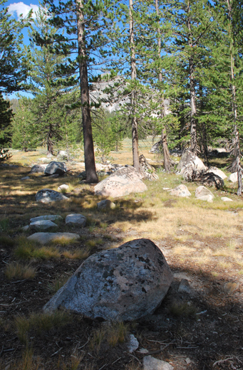
Latitude: N37°52.717'
Longitude: W119°21.798'
Elevation: 2627m
Location: Tuolumne Meadows
GPS Accuracy: 6m
Direction: 20
Photo Date: 8/8/2008
Time: 3pm
Latitude: N37°52.717'
Longitude: W119°21.798'
Elevation: 2627m
Location: Tuolumne Meadows
GPS Accuracy: 6m
Direction: 20
Photo Date: 8/8/2008
Time: 3pm
Vale (1987) Reference: 26
Vale (1994) Reference: 64
Photo Year: 1984
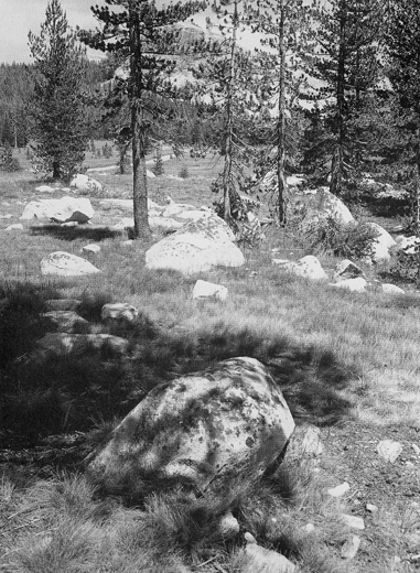
USGS Reference: 3111
Photographer: G.K. Gilbert
Year: 1903
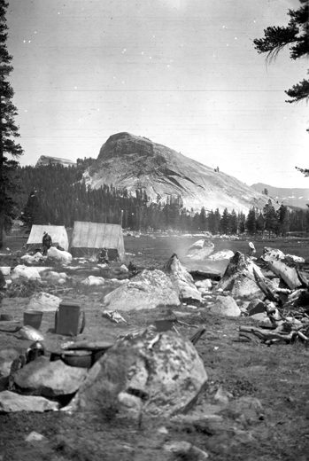
Caption: Yosemite National Park, California. Lambert Dome from near Soda
Springs in Tuolumne Meadows. The material is granite. Circa 1907.
Photo Credits: N.Wasserman (2008); Vale & Vale (1994). University of Utah Press; USGS
Inquires
- email the photographer