
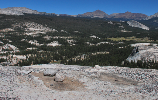
Name:
33-V33-US2136
Latitude: N37°53.113'
Longitude: W119°24.331'
Elevation: 2776m
Location: Tioga Road
GPS Accuracy: 3m
Direction: 10
Photo Date: 8/3/2008
Time: 2:45pm
Latitude: N37°53.113'
Longitude: W119°24.331'
Elevation: 2776m
Location: Tioga Road
GPS Accuracy: 3m
Direction: 10
Photo Date: 8/3/2008
Time: 2:45pm
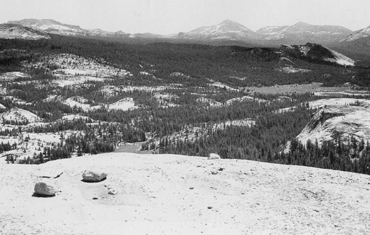
Vale (1987) Reference: 33
Vale (1994) Reference: 67
Photo Year: 1985
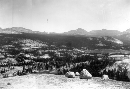
USGS Reference: 2136
Photographer: G.K. Gilbert
Year: 1903
Caption: Yosemite National Park, California. Moraine Flat, viewed from
a dome at the west. The view is nearly continuous with photo ggk02135.
The conical peak at the right of center is Mount Dana. In middle ground
is Round Meadow, traversed by the Tuolumne River; beyond it, Lambert Dome.
1903.
Photo Credits: N.Wasserman (2008); Vale & Vale (1994). University of Utah Press; USGS
Inquires
- email the photographer