
Name:
36-V36-US0782a
Latitude: N37°53.053'
Longitude: W119°22.702'
Elevation: 2619m
Location: Tuolumne Meadows
GPS Accuracy: 6m
Direction: 200
Photo Date: 8/8/2008
Time: 1pm
Latitude: N37°53.053'
Longitude: W119°22.702'
Elevation: 2619m
Location: Tuolumne Meadows
GPS Accuracy: 6m
Direction: 200
Photo Date: 8/8/2008
Time: 1pm

Vale (1987) Reference: 36
Vale (1994) Reference: print
Photo Year: N/A
No
Photo Available
USGS Reference: 0
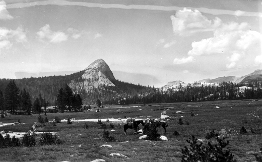
Photographer: F.E. Matthes
Year: 1936
Caption: Yosemite National Park, California. Fairview Dome, viewed from
lower Tuolumne Meadows. August 1936.
Photo Credits: N.Wasserman (2008); Vale & Vale (1994). University of Utah Press; USGS
Inquires
- email the photographer