
Name:
4-V04-US3135
Latitude: N37°55.601'
Longitude: W119°14.761'
Elevation: 3024m
Location: Tioga Pass
GPS Accuracy: 5m
Direction: 170
Photo Date: 7/12/2008
Time: 11:15am
Latitude: N37°55.601'
Longitude: W119°14.761'
Elevation: 3024m
Location: Tioga Pass
GPS Accuracy: 5m
Direction: 170
Photo Date: 7/12/2008
Time: 11:15am
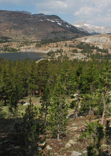
Vale (1994) Reference: 70
Photo Year: 1984

Photographer: G.K. Gilbert
Year: 1907
Caption: Portion of the rock rim of Tioga Lake,
Sierra Nevada. The outlet passes among the glaciated knobs at right of
lake. The whole area shown by the view was occupied by Pleistocene ice.
The ice movement in the nearer parts of the area was from left to right.
Mono County, California. ca. 1907.

Photo Credits: N.Wasserman (2008); Vale & Vale (1994). University of Utah Press; USGS
Inquires
- email the photographer