
Name:
40-V38-US2132
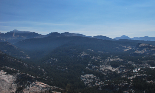
Latitude: N37°54.413'
Longitude: W119°25.846'
Elevation: 2663m
Location: Glen Aulin
GPS Accuracy: 9m
Direction: 70
Photo Date: 7/27/2008
Time: 9:10am
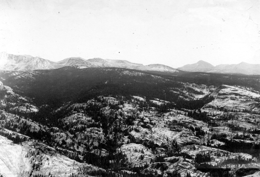
Latitude: N37°54.413'
Longitude: W119°25.846'
Elevation: 2663m
Location: Glen Aulin
GPS Accuracy: 9m
Direction: 70
Photo Date: 7/27/2008
Time: 9:10am
Vale (1994) Reference: print
Photo Year: N/A
No
Photo Available
USGS Reference: 2132
Photographer: G.K. Gilbert
Year: 1903
Caption: Yosemite National Park, California. The sky line includes Mount
Conness on the left and Mount Dana and Mount Gibbs on the right. To the
right of Mount Conness, and nearer than the sky line, is Ragged Peak.
The terrace system of the Conness Basin is traced about the base of Ragged
Peak and seen to merge with Moraine Flat, the timbered region on the right.
View is from a peak west of McGee Lake. 1903. Photos ggk02131, ggk02132,
and ggk02133 form a panorama.
Photo Credits: N.Wasserman (2008); Vale & Vale (1994). University of Utah Press; USGS
Inquires
- email the photographer