
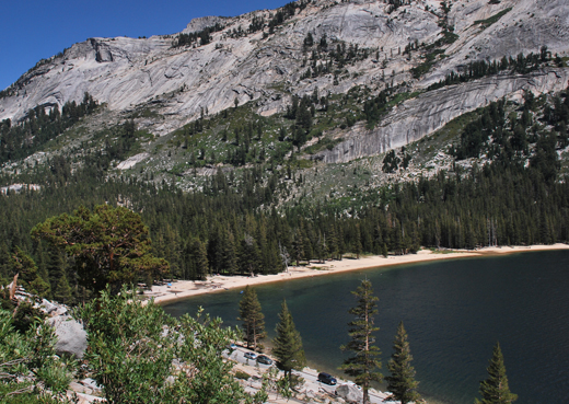
Name:
46-V44-US3118
Latitude: N37°50.169'
Longitude: W119°27.402'
Elevation: 2535m
Location: Tenaya Lake
GPS Accuracy: 8m
Direction: 10
Photo Date: 8/1/2008
Time: 2:30pm
Latitude: N37°50.169'
Longitude: W119°27.402'
Elevation: 2535m
Location: Tenaya Lake
GPS Accuracy: 8m
Direction: 10
Photo Date: 8/1/2008
Time: 2:30pm
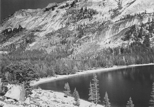
Vale (1987) Reference: 44
Vale (1994) Reference: 20
Photo Year: 1984
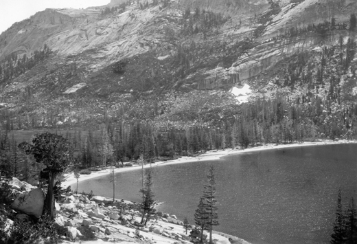
USGS Reference: 3118
Photographer: G.K. Gilbert
Year: 1907
Caption: Yosemite National Park, California. Head of Tenaya Lake. The
delta of the inlet stream occupies the whole width of the basin, being
margined by a waveN/A built beach which controls its outline. Circa 1907.
Photo
Credits: N.Wasserman (2008); Vale & Vale (1994).
Photo
Credits: N.Wasserman (2008); Vale & Vale (1994). University of Utah
Press; USGS
Inquires
- email the photographer