
Name:
5-V05-US3131
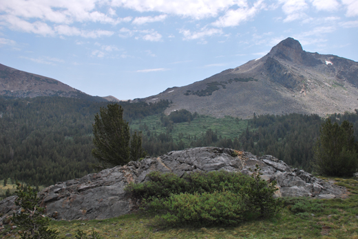
Latitude: N37°55.108'
Longitude: W119°15.308'
Elevation: 2976m
Location: Tioga Pass
GPS Accuracy: 4m
Direction: 330
Photo Date: 7/12/2008
Time: 11:45am
Latitude: N37°55.108'
Longitude: W119°15.308'
Elevation: 2976m
Location: Tioga Pass
GPS Accuracy: 4m
Direction: 330
Photo Date: 7/12/2008
Time: 11:45am
Vale (1994) Reference: 16
Photo Year: 1984
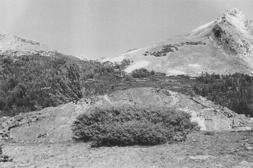
Photographer: G.K. Gilbert
Year: 1907
Caption: Glaciated boss of quartzite near Tioga
Lake. In the distance at left the mouth of a hanging valley (Glacier Valley)
between Mount Dana and Dana Plateau. Mono County, California, ca, 1907.

Photo Credits: N.Wasserman (2008); Vale & Vale (1994). University of Utah Press; USGS
Inquires
- email the photographer