
Name:
58-V56-US2067
Latitude: N37°48.240'
Longitude: W119°20.894'
Elevation: 3158m
Location: Vogelsang
GPS Accuracy: 6n
Direction: 210
Photo Date: 7/25/2008
Time: 2:50pm
Latitude: N37°48.240'
Longitude: W119°20.894'
Elevation: 3158m
Location: Vogelsang
GPS Accuracy: 6n
Direction: 210
Photo Date: 7/25/2008
Time: 2:50pm

Vale (1994) Reference: print
Photo Year: N/A
No
Photo Available
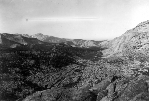
USGS Reference: 2067
Photographer: G.K. Gilbert
Year: 1903
Caption: Yosemite National Park, California. Valley of Emeric Creek and
Fletcher Creek, viewed from Tuolumne Pass. Between the creeks is a low
ridge. The granite of the foreground is traversed by a network of joints.
1903.
Photo Credits: N.Wasserman (2008); Vale & Vale (1994). University of Utah Press; USGS
Inquires
- email the photographer