
Name:
8-V08-US3116
Latitude: N37°53.787'
Longitude: W119°15.389'
Elevation: 2992m
Location: Tioga Pass
GPS Accuracy: 10m
Direction: 0
Photo Date: 8/2/2008
Time: 2:30pm
Latitude: N37°53.787'
Longitude: W119°15.389'
Elevation: 2992m
Location: Tioga Pass
GPS Accuracy: 10m
Direction: 0
Photo Date: 8/2/2008
Time: 2:30pm
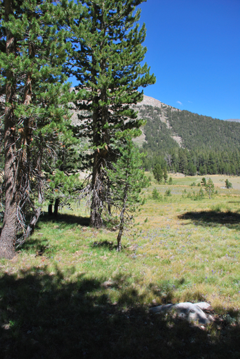
Vale (1994) Reference: 58
Photo Year: 1984

Photographer: G.K. Gilbert
Year: 1907
Caption: Yosemite National Park, California.
Portion of the western slope of Mount Dana, showing tracks of avalanches
which break the continuity of a forest of Murray pines. Altitude of mountain
shoulder is 11,200 feet; of foreground, 9,700 feet.

Photo Credits: N.Wasserman (2008); Vale & Vale (1994). University of Utah Press; USGS
Inquires
- email the photographer