
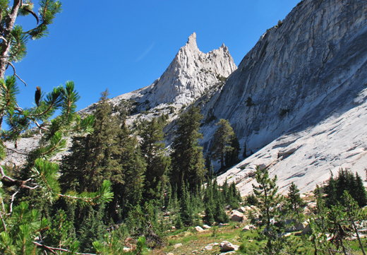
Name:
83-VBK-38
Latitude: N37°50.695'
Longitude: W119°24.762'
Elevation: 2906m
Location: Cathedral Lake
GPS Accuracy: 6m
Direction: 80
Photo Date: 8/3/2008
Time: 11:00am
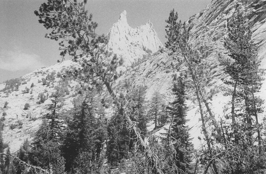
Latitude: N37°50.695'
Longitude: W119°24.762'
Elevation: 2906m
Location: Cathedral Lake
GPS Accuracy: 6m
Direction: 80
Photo Date: 8/3/2008
Time: 11:00am
Vale (1994) Reference: 38
Photo Year: 1987
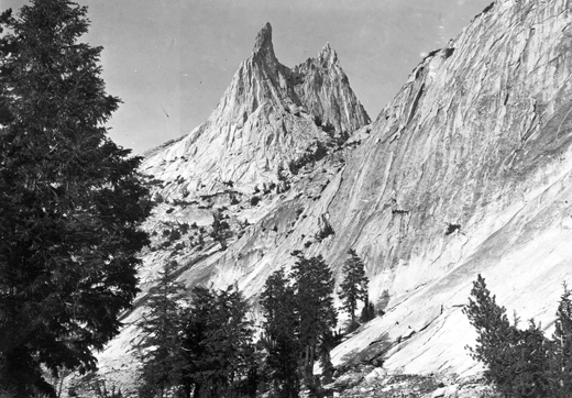
USGS Reference:
Photographer: F.C. Calkins
Year: 1913
Caption: Yosemite National Park, California. Cathedral Peak, viewed from
Sunrise trail. 1913.
Photo Credits: N.Wasserman (2008); Vale & Vale (1994). University of Utah Press; USGS
Inquires
- email the photographer