
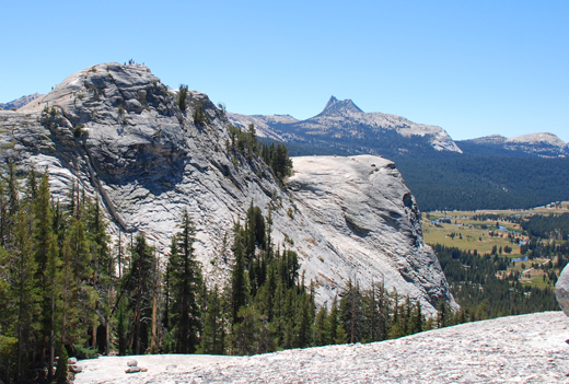
Name:
24-V24-US2164
Latitude: N37°53.031'
Longitude: W119°20.713'
Elevation: 2854m
Location: Tuolumne Meadows
GPS Accuracy: 3m
Direction: 210
Photo Date: 8/10/2008
Time: 2:20pm
Latitude: N37°53.031'
Longitude: W119°20.713'
Elevation: 2854m
Location: Tuolumne Meadows
GPS Accuracy: 3m
Direction: 210
Photo Date: 8/10/2008
Time: 2:20pm
Vale (1994) Reference: 33
Photo Year: 1984
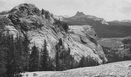
USGS Reference: 2164
Photographer: G.K. Gilbert
Year: 1903
Caption: Yosemite National Park, California. Chief summit of Lembert Dome,
viewed from a lower summit at the northeast. Tuolumne Meadows and Cathedral
Peak in the distance. 1903.

Photo Credits: N.Wasserman (2008); Vale & Vale (1994). University of Utah Press; USGS
Inquires
- email the photographer