Name:
29-V29-US3123
Latitude: N37°52.653'
Longitude: W119°23.711'
Elevation: 2616m
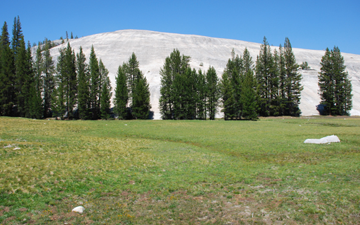
Location: Pothole Dome
GPS Accuracy: 11m
Direction: 170
Photo Date: 7/10/2008
Time: 10:10am
Latitude: N37°52.653'
Longitude: W119°23.711'
Elevation: 2616m
Location: Pothole Dome
GPS Accuracy: 11m
Direction: 170
Photo Date: 7/10/2008
Time: 10:10am

Vale (1987) Reference: 29
Vale (1994) Reference: 68
Photo Year: 1984

USGS Reference:
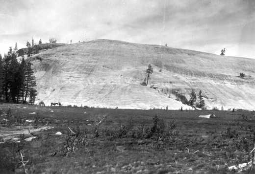
Photographer: G.K. Gilbert
Year: 1907
Caption: Yosemite National Park, California. Glaciated granite dome at
the west end of Tuolumne Meadows. The direction of ice movement was from
right to left. The line of glacial potholes is partly marked by trees,
and various tracts of the surface are covered by incipient potholes. Circa
1907.

Photo Credits: N.Wasserman (2008); Vale & Vale (1994). University of Utah Press; USGS
Inquires
- email the photographer
