
Name:
48-VBK-77
Latitude: N37°49.650'
Longitude: W119°28.051'
Elevation: 2493m
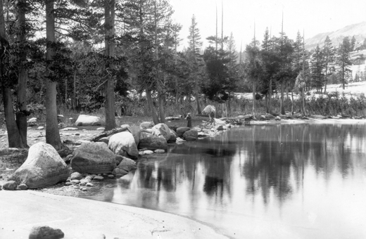
Location: Tenaya Lake
GPS Accuracy: 6m
Direction: 100
Photo Date: 8/1/2008
Time: 1pm
Latitude: N37°49.650'
Longitude: W119°28.051'
Elevation: 2493m
Location: Tenaya Lake
GPS Accuracy: 6m
Direction: 100
Photo Date: 8/1/2008
Time: 1pm

Vale (1994) Reference: 77
Photo Year: 1984

USGS Reference: 3151
Photographer: G.K. Gilbert
Year: 1907
Caption: Yosemite National Park, California. IceN/Aformed rampart on the
shore of Tenaya Lake. Circa 1907.
Photo Credits: N.Wasserman (2008); Vale & Vale (1994). University of Utah Press; USGS
Inquires
- email the photographer