
Name:
61-V59-US2177
Latitude: N37°46.774'
Longitude: W119°22.882'
Elevation: 2856m
Location: Vogelsang
GPS Accuracy: 10m
Direction: 260
Photo Date: 7/25/2008
Time: 9am
Latitude: N37°46.774'
Longitude: W119°22.882'
Elevation: 2856m
Location: Vogelsang
GPS Accuracy: 10m
Direction: 260
Photo Date: 7/25/2008
Time: 9am

Vale (1994) Reference: 12
Photo Year: 1984

USGS Reference: 2177
Photographer: G.K. Gilbert
Year: 1903
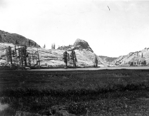
Caption: Yosemite National Park, California. Emeric Dome, viewed from
the north across Emeric Lake. The ridge extending northeastward from the
dome shows anticlinal joints. 1903.
Photo Credits: N.Wasserman (2008); Vale & Vale (1994). University of Utah Press; USGS
Inquires
- email the photographer