
Name:
82-VBK-32
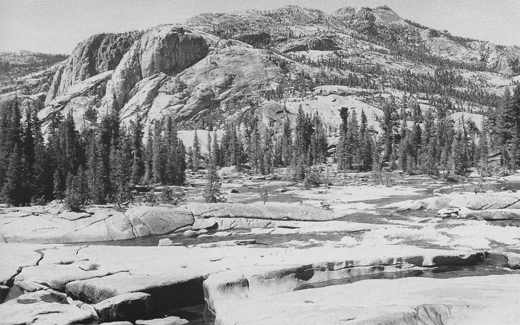
Latitude: N37°54.240'
Longitude: W119°24.929'
Elevation: 2502m
Location: Glen Aulin
GPS Accuracy: 5m
Direction: 130
Photo Date: 7/27/2008
Time: 10:40am
Latitude: N37°54.240'
Longitude: W119°24.929'
Elevation: 2502m
Location: Glen Aulin
GPS Accuracy: 5m
Direction: 130
Photo Date: 7/27/2008
Time: 10:40am

Vale (1987) Reference: N/A
Vale (1994) Reference: 32
Photo Year: 1987
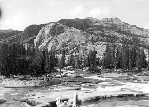
USGS
Reference:
Photographer: F.C. Calkins
Year: 1913
Caption: Yosemite National Park, California. Glaciated mountains north
of Glen Aulin. Striae rising toward the left or downstream. 1913.
Photo Credits: N.Wasserman (2008); Vale & Vale (1994). University of Utah Press; USGS
Inquires
- email the photographer